ARK V3.0 / Customized Portal / Domain Specialist

Specialist
Admin.
The integration of multi-domain adaptation resources, including climate change risk identification maps, adaptation simulators, and demonstration cases, can serve as reference materials for policy planning by central government agencies.
Sectoral risk adaptation: Providing risk assessment and adaptation information across multiple sectors throughout Taiwan


Select function


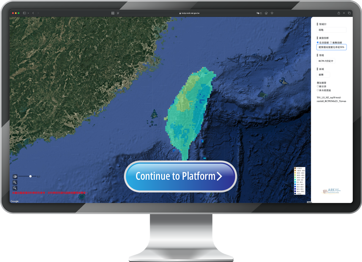
Typhoon and rainfall events
| Climate Scenarios | (RCP8.5 mid-century, RCP8.5 end-century), GWL2°C, GWL4°C |
| Hazard Indicators | Top 30% events of maximum 6-hour cumulative rainfall change rate, maximum 12-hour cumulative rainfall change rate, maximum 24-hour cumulative rainfall change rate, and total cumulative rainfall change rate |
| Impact Indicators | Landslide probability |
| Data Type | AR5 Dynamical downscaling |
| Spatial Resolution | 0.05 degree |
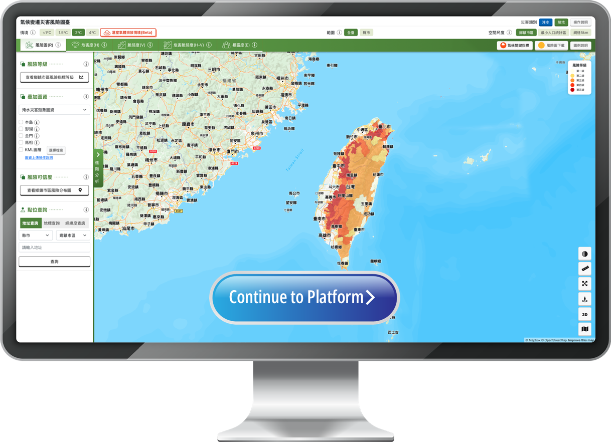
Typical precipitation events
| Climate Scenarios | SSP1-2.6、SSP2-4.5、SSP3-7.0、SSP5-8.5、≒GWL 1°C、GWL 1.5°C、GWL 2°C、GWL 4°C |
| Hazard Indicators | Rainfall probability |
| Impact Indicators | Risk map (R), hazard (H), vulnerability (V), exposure (E), hazard-vulnerability (H-V), and other indicators |
| Data Type | AR6 statistical downscaling |
| Spatial Resolution | All of Taiwan (5 km grid), township/city/district, smallest population statistical units |